




Nestled high in the Peruvian Andes, the 7 Lakes of Ausangate offer one of the most spectacular landscapes in the Cusco region. While thousands of travelers visit Machu Picchu and Rainbow Mountain every day, this hidden destination remains relatively untouched, rewarding visitors with crystal-clear glacial lakes, towering snow-capped peaks, colorful valleys, and authentic Andean culture.
Located at the foot of the majestic Ausangate Mountain, the highest peak in the Cusco region, this unforgettable hike takes you through breathtaking scenery where turquoise, emerald, and deep blue lakes reflect the surrounding glaciers. Along the way, you’ll encounter herds of alpacas and llamas, traditional Quechua communities, and the soothing natural hot springs of Pacchanta.
Whether you’re looking for a peaceful alternative to Peru’s more crowded attractions or planning an adventure filled with stunning photography opportunities, the 7 Lakes of Ausangate should be at the top of your travel list.
What Are the 7 Lakes of Ausangate?
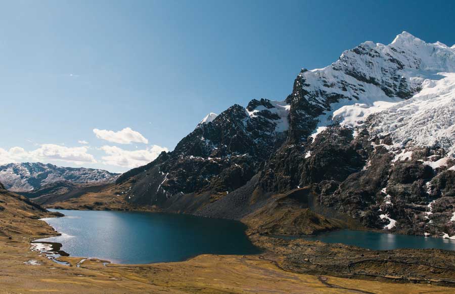
The 7 Lakes of Ausangate are a collection of glacial lakes located near Pacchanta, a small Andean village in the Ocongate district, Quispicanchi province, roughly three hours southeast of Cusco.
Fed by the melting glaciers of Ausangate Mountain, each lake displays a unique shade of blue or green thanks to the minerals found in the surrounding mountains. Together, they create one of the most picturesque hiking routes in southern Peru.
One thing worth knowing upfront: there isn’t a single “official” list of the seven lakes. Different communities, guides, and tour operators name slightly different combinations depending on the route they follow, so two travelers can both hike the “7 Lakes circuit” and end up seeing a different set of lakes. Still, a core group of names shows up on nearly every route.
Why Visit the 7 Lakes of Ausangate?
Incredible Mountain Scenery
The route offers continuous panoramic views of Ausangate Mountain, which rises to over 6,384 meters (20,945 feet)above sea level, along with neighboring peaks like Jampa, Pucapunta, and Tinke.
Seven Unique Glacial Lakes
Each lake has its own personality and color. Depending on the weather and sunlight, the water can appear turquoise, emerald green, sapphire blue, or even silver.
Authentic Andean Culture
The local communities still preserve centuries-old traditions. Visitors often see local shepherds wearing traditional clothing while raising alpacas and llamas.
Relaxing Hot Springs
After completing the hike, travelers can unwind in the natural hot springs of Pacchanta while enjoying incredible mountain views.
Where Are the 7 Lakes of Ausangate?
The lakes are located in the Vilcanota Mountain Range, about 100–120 kilometers (62–75 miles) southeast of Cusco, in the community of Pacchanta.
The adventure begins in Pacchanta, situated at approximately 4,200–4,300 meters (13,780–14,100 feet) above sea level. From there, hikers follow a scenic trail through high-altitude valleys, passing several of the seven glacial lakes before looping back to the village.
How to Get to the 7 Lakes of Ausangate
Most visitors join a full-day guided tour from Cusco, typically departing very early between 3:00 and 4:30 a.m. to make the most of the day.
The drive to Pacchanta takes around 3 to 3.5 hours, passing through traditional Andean villages and high-altitude farmland.
Independent travelers can take a bus or combi from Av. Tomasa Tito Condemayta in Cusco to the town of Tinki (about 3 hours), then a taxi to Pacchanta (roughly 30 more minutes). That said, a guided tour is usually more convenient given limited public transport schedules and the logistics of hiking at altitude.
The Seven Lakes
Each lake is formed by glacial meltwater and offers spectacular scenery. Names that recur across most routes include:
- Azulcocha, known for its brilliant turquoise color.
- Pucacocha, surrounded by rugged mountain slopes.
- Alqacocha, famous for its crystal-clear water.
- Otorongo Macho and Otorongo Hembra (sometimes grouped together as one “Otorongo Lake”), reflecting the snow-covered peaks.
- Qomercocha, with striking emerald tones.
- Patacocha, located at one of the higher points of the route.
Exact lake names and order can vary slightly by operator, but the character of the circuit vividly colored lakes ringed by glaciers stays consistent.
Hiking Difficulty
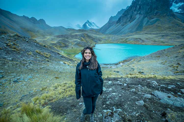
The 7 Lakes of Ausangate hike is considered moderately challenging to challenging.
The trail itself isn’t technically difficult, but the high altitude makes the trek more demanding than many visitors expect.
The hike covers roughly 10 to 16 kilometers (6–10 miles) depending on the route, and takes approximately 4 to 6 hours. Several uphill sections require a reasonable level of fitness.
Altitude and Acclimatization
One of the biggest challenges is the elevation.
The hike begins at around 4,200–4,300 meters (13,780–14,100 feet) and reaches elevations close to 4,600–4,850 meters (15,100–15,900 feet), depending on the route.
To reduce the risk of altitude sickness, it’s highly recommended to spend at least two or three days in Cusco before attempting the hike. Drinking plenty of water, avoiding alcohol, eating light meals, and walking at a comfortable pace will help your body adjust.
Best Time to Visit
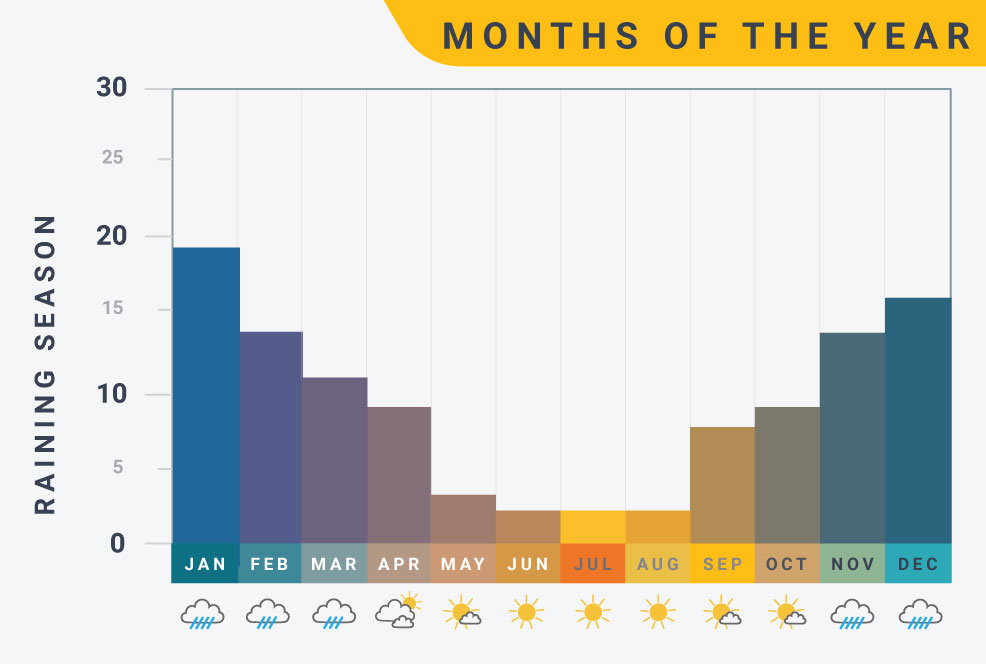
The best months to visit are during the dry season, from April to October, which usually brings:
- Clear blue skies
- Better mountain views
- Less rainfall
- Safer hiking conditions
- Excellent photography opportunities
The rainy season runs from November to March, when trails may become muddy and cloud cover can partially hide the surrounding peaks. However, the landscape turns greener, creating a beautiful contrast with the glaciers.
Flora and Wildlife
The region is home to a surprising variety of wildlife despite its harsh climate. During the hike, you may encounter:
- Alpacas and llamas
- Vicuñas and viscachas
- Andean geese and mountain ducks
- Caracara birds
- Occasionally, Andean foxes and condors
Native high-altitude plants and colorful wildflowers cover the valleys, adding even more beauty to the landscape.