



The Qhapaq Ñan: The Inca Road Network of the Empire and Its Legacy in Peru and the Andes
The Qhapaq Ñan was the central axis of the Inca Civilization, one of the most powerful and sophisticated societies in pre-Columbian history, which flourished in South America during the 15th and 16th centuries. With its capital in Cusco, in present-day Peru, the Inca Empire extended across a vast region from southern Colombia to northern Chile and Argentina, covering much of modern-day Peru, Ecuador, and Bolivia. This remarkable expansion reflects the strength, organization, and enduring cultural heritage of the Inca people.
One of the most extraordinary achievements of the Inca was their extensive road system, known as the Qhapaq Ñan or the Great Inca Road Network. This engineering marvel connected the entire empire through thousands of kilometers of pathways across the Andes, deserts, and forests. Today, parts of this network are recognized as a UNESCO World Heritage site, highlighting its global importance and preservation as a symbol of Peruvian identity.
| Qhapaq Ñan Quick Facts: | Key Information at a Glance |
|---|---|
| Total Length: | Over 40,000 km (25,000+ miles) of interconnected roads |
| Countries Covered: | Peru, Ecuador, Bolivia, Colombia, Chile, and Argentina |
| Civilization: | Built by the Inca Empire |
| UNESCO Recognition: | Declared a World Heritage Site in 2014 |
| Geography: | Crosses the Andes Mountains, deserts, and tropical forests |
| Top Experience: | Hiking the Inca Trail to Machu Picchu |
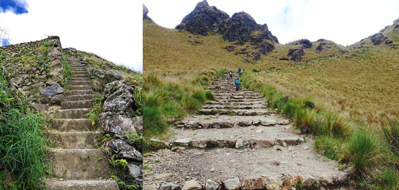
The Inca road system played a vital role in administration, trade, and communication, allowing messengers (chasquis) and armies to move quickly across challenging terrain. It also featured impressive infrastructure such as suspension bridges, stone-paved paths, tunnels, and stairways carved into mountainsides.
Many of these ancient routes are still in use today and form the basis of iconic experiences, like the Classic Inca Trail trek to Machu Picchu. This world-famous trek offers travelers not only breathtaking landscapes but also a deep connection to the history and legacy of the Inca Empire, making it one of the most meaningful journeys through a UNESCO World Heritage landscape. Currently, many tourists find themselves walking on an Inca Jungle tour, trekking through these historic paths that once united an entire continent.
1. Qhapaq Ñan: The Inca Road Network
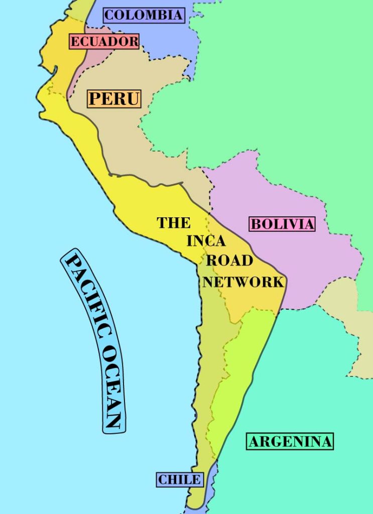
The Qhapaq Ñan, meaning “main road” in Quechua, was the extensive Inca road network that formed the backbone of the Inca Empire’s power and organization. This important road network, built by the Inca under rulers such as Inca Yupanqui, connected the vast territories of the empire across the Andes Mountains, linking the heart of the Inca Empire in Cusco with distant regions.
This remarkable system often referred to as the Great Inca Trail or Inca Trail network was more than just infrastructure; it was a journey through history, representing the legacy of the Inca roads and the enduring brilliance of Inca culture. Today, many travelers can still hike the Inca Trail, following the footsteps of the Incas along ancient roads that were carefully built by the Incas.
The Inca Trail is one of the most iconic sections of this network and remains a protected cultural treasure. In fact, the Inca Trail is a protected route and part of the broader UNESCO World Heritage-recognized Qhapaq Ñan, preserving the rich history, history and culture, and history and natural beauty of the Andes.
1.1 Characteristics of the Qhapaq Ñan
The road network of the Inca extended over 40,000 kilometers, making it one of the most advanced transportation systems in the ancient world. This extensive network connected key cities and sacred Inca sites, forming the network of the Inca Empire.
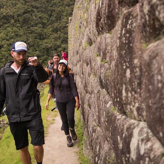
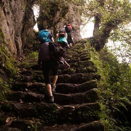
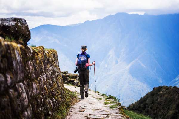
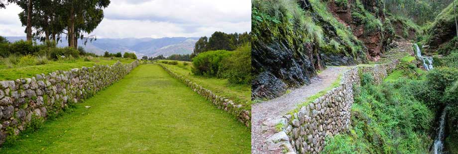
Rather than imposing rigid construction, the Incas adapted their Inca pathways to the environment. Along the Inca routes, travelers encounter stone-paved trails, stairways carved into cliffs, and remarkable engineering solutions such as drainage systems and suspension bridges.
The construction of the Qhapaq Ñan demonstrates the ingenuity of the Inca state, which organized labor and resources to build infrastructure that could withstand the harsh conditions of the Andes. Many of these sections of the Qhapaq Ñan are still visible today and continue to inspire modern exploration.
1.2 Diversity of Routes
The Qhapaq Ñan, or the Great Inca Road, was a marvel of ancient engineering that stretched over 30,000 kilometers, uniting one of the most diverse territories on Earth. This network was the backbone of the Inca Empire, designed to move armies, messengers (chasquis), and resources across ecosystems that most civilizations would find impassable.
To understand their mastery, we can compare how the Incas adapted their construction techniques to three distinct environments:
| Feature | Mountain Routes (Andean) | Coastal Routes (Desert) | Jungle Routes (Amazonian) |
| Terrain | Steep peaks and deep canyons. | Flat, arid deserts and fertile valleys. | Humid, dense vegetation and mud. |
| Engineering Key | Stone steps and suspension bridges. | Adobe walls and markers to prevent getting lost in sand. | Stone paving and drainage to handle heavy rain. |
| Primary Use | Military movement and spiritual pilgrimages. | Trade of seafood, salt, and cotton. | Sourcing coca leaves, feathers, and exotic wood. |
| Modern Experience | The classic Inca Trail to Machu Picchu. | Archaeological sites near the Pacific coast. | Remote trails in the “Cloud Forest” (Ceja de Selva). |
The adaptability of the Incas was legendary. In the mountains, they built massive retaining walls and used the natural rock to create stairs that defied gravity. On the coast, where stone was scarce, they used sun-dried mud bricks (adobe) to define the path and built “tambos” (resting houses) near water sources. In the jungle, they focused on sophisticated drainage systems to ensure the roads wouldn’t wash away during the tropical rainy season.
This network wasn’t just a road; it was a physical manifestation of the Inca’s power to harmonize human architecture with the raw forces of nature.
1.3 Secondary Road Network
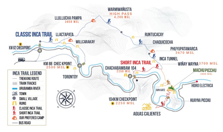
Among all the sections of the Qhapaq Ñan, the most famous Inca Trail is the route leading to Machu Picchu. The Classic 4-Day Inca Trail is the most popular option, offering a perfect balance of challenge, scenery, and immersion in history and culture.
For those with limited time, the Short Inca Trail provides a condensed yet unforgettable experience. Both routes allow travelers to walk along the Inca Trail, explore ancient ruins, and witness the incredible history and natural beauty of the Andes.
The Inca Trail offers a unique opportunity to discover hidden Inca sites, pass through cloud forests, and follow original paths built by the Inca. Every step becomes a meaningful journey through history, deeply connected to the culture of the Andes.
1.4 Coastal Route and Jungle Route
The Qhapaq Ñan was divided into several major axes that connected different regions of the empire. Two of the most important were:
- The Coastal Road: This route connected the central region of the Inca Empire to the Pacific coast. Along this road, maritime trade and the movement of coastal peoples, who had important relations with the Andean peoples, were facilitated.
- The Jungle Road: This road crossed the lowlands of the Amazon, connecting the Amazonian regions to the rest of the empire.
2. Purpose and Functions of the Inca Routes
The Inca roads served more than just transportation; they fulfilled several crucial roles in the functioning of the empire.
2.1 Communications and Administration
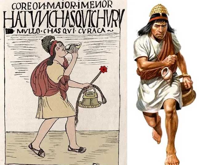
The Qhapaq Ñan was a vital tool for administration and control of the empire. It allowed messages and orders from the central government in Cusco to be rapidly disseminated throughout the empire’s various regions. The chaskis, trained runners who could travel great distances at high speed, were responsible for transporting information between different parts of the empire. These runners benefited from the road network, as they could cover large distances in a relatively short time due to the efficiency of the infrastructure.
2.2 Transport of Goods and Resources
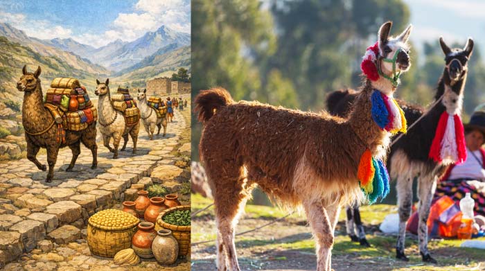
Trade between different regions of the empire was another essential function of the road network. The Qhapaq Ñan allowed the transportation of agricultural products, textiles, ceramics, metals, and other goods between the various regions of the Andes. Additionally, the road system facilitated the distribution of vital resources such as maize, coca, and quinoa, which were used to sustain populations in both highland and lowland areas of the empire.
2.3 Military Mobilization
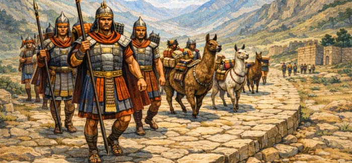
Military control was another key aspect of the Qhapaq Ñan. Thanks to this road network, the Inca army could quickly mobilize to suppress uprisings or face off against peoples who threatened the stability of the empire. Communication and rapid response were essential for managing such an extensive and diverse territory. Furthermore, the roads allowed the movement of troops and supplies to the empire’s borders or newly conquered territories, ensuring the maintenance of imperial control.
2.4 Cultural and Religious Integration
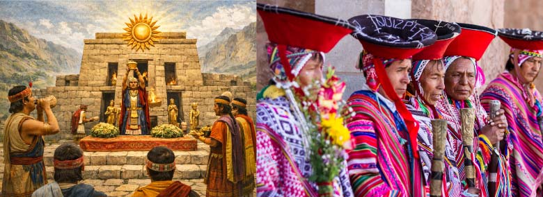
The Qhapaq Ñan also facilitated cultural and religious integration. The Incas were keenly aware of the importance of religion in unifying their empire, so they built temples, shrines, and ceremonial sites along the routes, such as the famous Temple of the Sun in Cusco. These sites marked spiritual contact points and integration spaces for the peoples under Inca rule.
2.5 Redistribution of Food and Resources
The road network also played a key role in the redistribution of resources within the empire. Thanks to terrace farming and the ayni (communal labor) system, the empire could efficiently move resources to ensure that populations in different regions could survive during times of scarcity or natural disasters. The roads made it possible to distribute food and other essential resources equitably.
3. Strategic Importance of the Qhapaq Ñan
The legacy of the Inca roads continues to this day, standing as a testament to a civilization that prioritized connectivity as a tool for survival. The extensive road network did not merely provide physical paths; it served as a sophisticated mechanism that unified the Tawantinsuyu culturally, politically, and economically. By standardizing travel and transport, the Incas ensured that the diverse traditions and resources of distant regions were integrated into a single imperial identity.
Even after the fall of the empire, the durability of these stone paths allowed many sections to remain in use for centuries, often serving as the foundation for modern colonial and Republican routes. Today, they form a vital part of a protected UNESCO heritage, allowing visitors from around the globe to explore the Inca Trail network and appreciate the engineering brilliance of one of the world’s greatest civilizations. Walking these ancient roads is far more than a simple hike; it is an immersive experience that allows travelers to connect with history, follow the literal footsteps of the Incas, and feel the enduring spirit of the Andes.
3.1 Connection between Cusco and Peripheral Regions
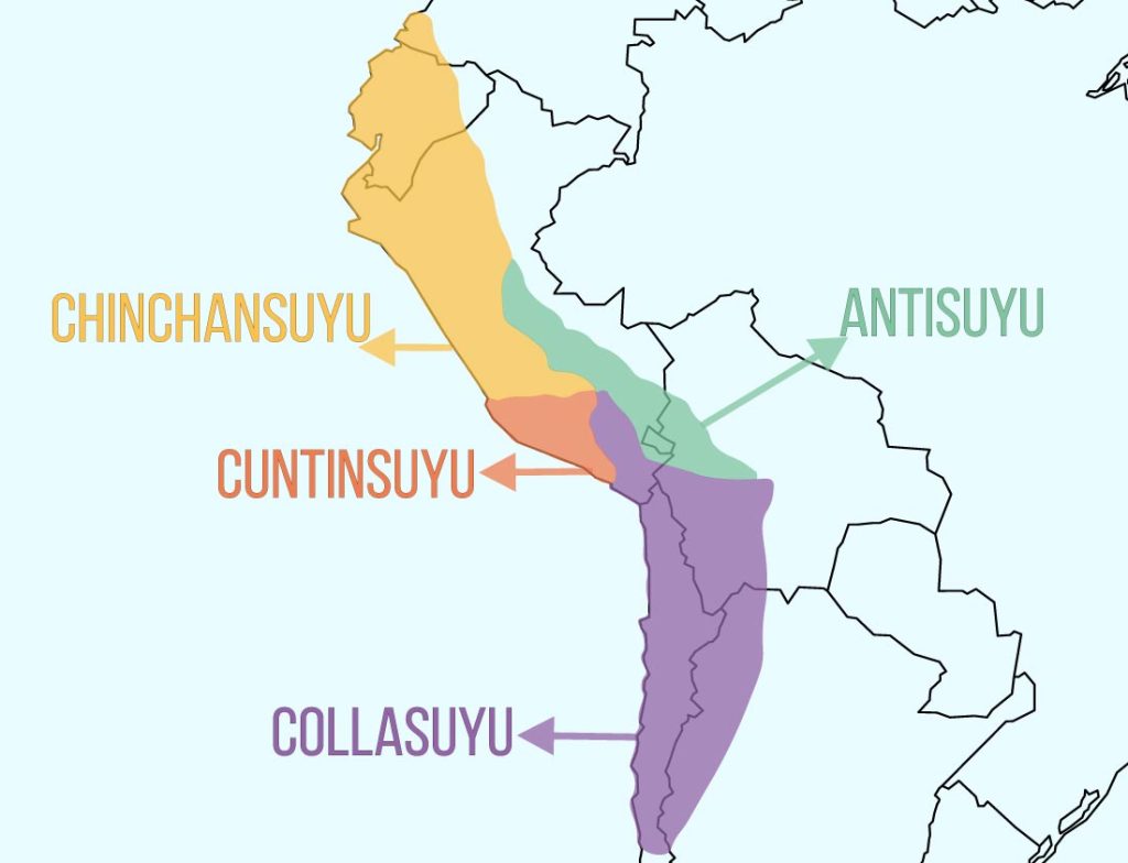
The main axes of the Qhapaq Ñan radiated from the Huacaypata (Cusco’s main plaza), reaching the four corners of the empire known as the Suyus. These roads were the primary instrument for the central government to exert authority over newly conquered or annexed territories. Beyond military use, they served as a “civilizing” force, integrating remote communities into the Inca socioeconomic structure. The fact that these roads traversed vertical mountain ranges, shifting desert sands, and humid cloud forests demonstrates an advanced understanding of geology and hydraulics, ensuring that even the most peripheral region remained within the reach of the Sapa Inca.
3.2 Role of Administrative Centers (Tambos)
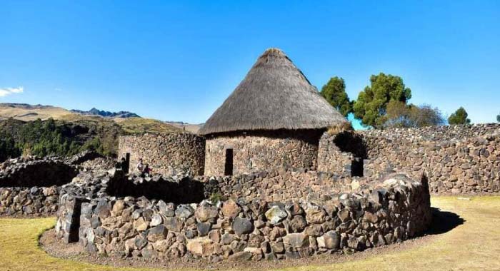
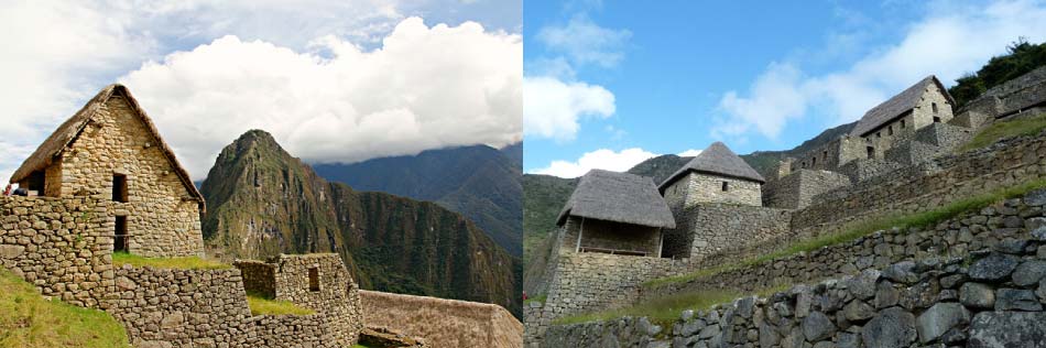
Strategic control was maintained through an extensive network of administrative centers known as tampu (or tambos), positioned at regular intervals (usually one day’s walk apart, approximately 20 to 30 km). These were not simple rest stops; they were complex logistics hubs equipped with qollqas (storage silos) filled with grain, textiles, and weapons to supply the imperial army and traveling officials. These centers acted as trade hubs and tax collection points, where the mit’a (labor tax) was organized. By maintaining these depots, the Inca state could manage resources efficiently, preventing famine and ensuring the stability of the empire during times of crisis.
3.3 The Chaski Messenger System
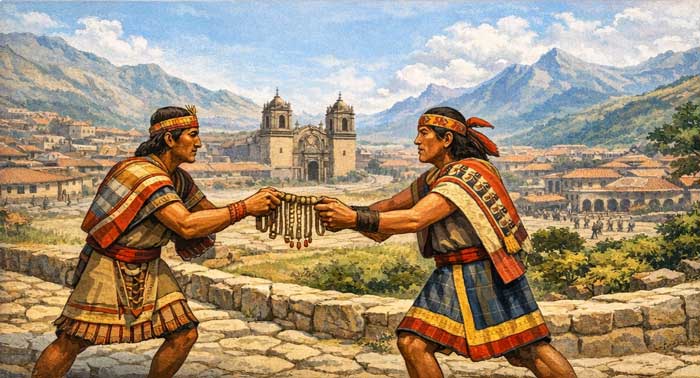
The efficiency of the Inca messenger system was unparalleled in the pre-industrial world. The Chaskis, elite runners trained from a young age for endurance and speed, operated through a relay system (postas) stationed at small huts called chuklas. This allowed a message to travel from the coast to Cusco a distance of over 400 km in less than 24 hours. They carried official oral messages, recorded data on Quipus (knotted strings), and even fresh goods for the nobility. This rapid communication was the backbone of the empire’s administration, providing the central government with real-time intelligence on crop conditions, social unrest, or military threats, allowing for a swift and organized response.
3.4 Engineering as a Tool of Power
The strategic importance was also reflected in the design of the infrastructure. The Incas built suspension bridges (q’eswachaka) to cross massive canyons, tunnels through solid rock, and retaining walls to prevent landslides. These features were not just functional; they were symbols of the Inca state’s power to conquer and tame the wild landscape. By controlling these key “bottlenecks” (bridges and narrow passes), the Inca military could easily monitor movement and protect the heart of the empire from external invasions.
4. The Fall of the Inca Empire and the Legacy of the Qhapaq Ñan
The arrival of Spanish conquistadors in the 16th century marked the decline of the Incan Empire and led to the eventual collapse of one of the most sophisticated civilizations in the Americas. As colonial rule expanded, many of the ancient routes lost their original administrative and political functions. However, despite this transformation, the Qhapaq Ñan endured as a powerful symbol of innovation and connectivity.
The vast network of roads connected distant regions across an incredibly diverse geography, from coastal deserts to the high Andes mountains. These routes were not only pathways but lifelines of the empire. The Incas built roads with remarkable precision, adapting to the rugged terrain of the high Andes through advanced engineering techniques.Stone-paved paths, stairways carved into cliffs, and suspension bridges allowed safe passage across some of the most challenging landscapes on Earth.
The Qhapaq Ñan included thousands of kilometers of routes that integrated communities and facilitated communication, trade, and cultural exchange. Even after the fall of the empire, many of these paths remained in use by local populations, demonstrating their durability and importance. Today, several routes are still visible and accessible, forming part of the Qhapaq Ñan that travelers can explore.
In recognition of its global value, the Qhapaq Ñan was declared a UNESCO World Heritage Site in 2014. This designation highlights not only its historical and cultural importance but also the extraordinary achievements of the civilization that designed it. The fact that the Incas built such an extensive road system without modern technology continues to inspire historians, engineers, and travelers alike.
5. Conclusion
The Qhapaq Ñan stands as one of the greatest engineering achievements of the ancient world, rivaling the famous road networks of the Roman Empire. This vast system of pathways was not merely a feat of construction but the vital central nervous system of the Incan Empire. By overcoming some of the most rugged terrains on the planet, it allowed for the efficient governance and seamless expansion of a territory that stretched across the spine of South America, uniting six modern-day nations under a single administrative vision.
These roads were the lifeblood of the Andes, serving as essential conduits for rapid communication, large-scale transportation, and deep cultural integration. By connecting major administrative hubs like Cusco with the most remote mountain and jungle communities, the Inca state enabled the fluid movement of goods, strategic information, and diverse populations. The ability to engineer durable paths through vertical Andean peaks, arid coastal deserts, and dense tropical forests demonstrates the unparalleled ingenuity and strategic foresight of the Inca civilization. They did not simply build over nature; they harmonized human architecture with the environment, creating a sustainable infrastructure that has survived for half a millennium.
Today, the legacy of the Qhapaq Ñan lives on as more than an archaeological treasure; it is a living pathway through history. Many sections, particularly those high in the Andes, remain integral to the daily lives of modern indigenous communities, serving the same purposes of connectivity they did centuries ago. For the global traveler, these routes from the Classic Inca Trail to the adventurous Inca Jungle paths offer a unique, firsthand opportunity to witness the sophisticated urban planning of a unified empire.
The enduring presence of the Qhapaq Ñan serves as a powerful reminder of a civilization that achieved total territorial integration without modern technology. As a UNESCO World Heritage site, it continues to shape the cultural identity of the Andean people and remains a symbol of human resilience. Exploring these ancient stones is not just a hike; it is a journey into the soul of an empire whose technological and social achievements continue to inspire the world today.